Back زانكت غوار Arabic زانکت قوار AZB Sankt Goar Catalan Санкт-Гоар CE Sankt Goar (munisipyo) CEB Sankt Goar Danish Sankt Goar German Sankt Goar Esperanto Sankt Goar Spanish زانکت گوار Persian
Sankt Goar | |
|---|---|
 View of St. Goar (in top half of picture) from Patersberg | |
| Coordinates: 50°9′N 7°43′E / 50.150°N 7.717°E | |
| Country | Germany |
| State | Rhineland-Palatinate |
| District | Rhein-Hunsrück-Kreis |
| Municipal assoc. | Hunsrück-Mittelrhein |
| Subdivisions | 4 |
| Government | |
| • Mayor (2019–24) | Falko Hönisch[1] (SPD) |
| Area | |
| • Total | 22.93 km2 (8.85 sq mi) |
| Elevation | 74 m (243 ft) |
| Population (2022-12-31)[2] | |
| • Total | 2,928 |
| • Density | 130/km2 (330/sq mi) |
| Time zone | UTC+01:00 (CET) |
| • Summer (DST) | UTC+02:00 (CEST) |
| Postal codes | 56329 |
| Dialling codes | 06741 |
| Vehicle registration | SIM, GOA |
| Website | www |
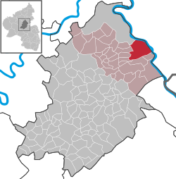
Sankt Goar is a town on the west bank of the Middle Rhine in the Rhein-Hunsrück-Kreis (district) in Rhineland-Palatinate, Germany. It belongs to the Verbandsgemeinde Hunsrück-Mittelrhein, whose seat is in Emmelshausen.
Sankt Goar is well known for its central location in the Rhine Gorge, a UNESCO World Heritage Site since July 2002. Above the town stand the ruins of Burg Rheinfels, one of the castles for which the Middle Rhine is famous, and across the river lies the sister town of Sankt Goarshausen with its own castles, Katz and Maus (“Cat” and “Mouse”). The famous Lorelei rock is close by, slightly upstream on the opposite bank.
- ^ Direktwahlen 2019, Rhein-Hunsrück-Kreis, Landeswahlleiter Rheinland-Pfalz, accessed 4 August 2021.
- ^ "Bevölkerungsstand 2022, Kreise, Gemeinden, Verbandsgemeinden" (PDF) (in German). Statistisches Landesamt Rheinland-Pfalz. 2023.


